Magical Mountains
86+ KM Thangool | Kroombit Tops
Experience the magic of Mount Scoria and Kroombit Tops in this ‘twin peaks’ adventure
Thangool to Mount Scoria
Thangool to Mount Scoria 6.5 KM | 8 MINS
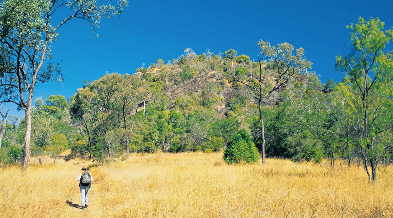
Known as the ‘Musical Mountain’, the rocks found at Mount Scoria are uniquely formed, multisided pillars, naturally formed from the cooling effects of an ancient volcano. The rocks resonate when they are struck, making a humming sound.
Start at Hotel Thangool in Ramsay St, opposite the BP Service Station. TURN LEFT into Winston Street and drive 1.5 km. Be careful crossing the narrow one-way bridge just before the race track. TURN LEFT onto Thangool-Lookerbie Road and follow for about 5 km. After you cross Grevillea Creek, TURN RIGHT into Mount Scoria.
Take a short cultural interpretative walk along the track at the base of the mountain and discover its significance to the Gangulu people. Have a picnic lunch at the grounds, while you spot native birds and animals in the surrounding bushland.
Download a PDF of this itinerary from the Sandstone Wonders website (click here).

Mount Scoria to Kroombit Tops
Mount Scoria to Kroombit Tops 45 KM | 40 MINS
From Mount Scoria, head back the way you came to Thangool (note: Winston Street is called Aerodrome Rd when turning right off Thangool-Lookerbie Road to cross over the narrow bridge).Once you reach the BP Service station (on your left), TURN LEFT onto Burnett Highway and drive for 7.2 km towards Biloela.
Just after crossing Kroombit Creek, TURN RIGHT onto Vantallies Road. Travel 1.4 km and TURN RIGHT onto Valentine Plains Road. Approximately 22 km along the road, the surface changes to gravel. Continue a further 2 km to Kroombit Dam on your left. About 300 m after you pass through Kroombit Creek, you’ll see a turnoff on the left that leads to Kroombit Dam Lookout. It is definitely worth the short drive.
Back on Valentine Plains Road continue along for another 2.7 km, pass over another grid and veer right onto Alcocks Road. Follow Alcocks Road for 1.7 km and you’ll pass over another grid. Veer right onto Kroombit Station Road and follow to Lochenbar Station.
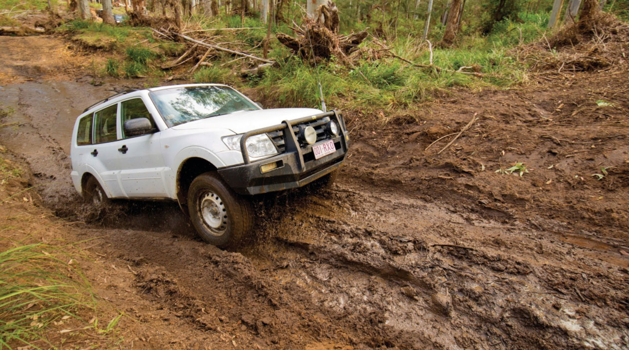
If you do not have a high clearance 4WD – DO NOT VENTURE ANY FURTHER – head back to Biloela. DO NOT ATTEMPT RAZORBACK WITH A CAMPER TRAILER OR FOLLOWING WET WEATHER.
Biloela to Lochenbar and Kroombit Tops (4WD ONLY)
Lochenbar to Kroombit Tops (4WD ONLY) 4 hrs
If you’re in a high clearance 4WD, follow the track further on to Kroombit Tops. This track is known as “Razorback” and has some testing uphill and rocky sections. Choose your path before each section. Some sections will require Low Range 4WD with Lockers on. There are some gates along the way-please close them after entry.
The track will offer up some unbelievable natural scenery, so take your time and enjoy. Once you are through Razorback, the park is very well signed, so take advantage of the Natural and Historical sites, such as:
• Beautiful Betsy Bomber Crash Site
• The Wall
• Kroombit Tops Lookout-this offers up spectacular views.
• The park has some great picnic and camping sites. Camping permits are available through National Parks Website, so if you are planning an overnight, get your permit before you go (phone reception points are available throughout the park, but reception is patchy).